This Open File Report, 2003-22, serves to reference the results of the Kansas Geological Survey's contract with the Kansas Department of Agriculture's, Division of Water Resources Contract No 1500. The Kansas Geological Survey compiled these maps using what is thought to be the most reliable information available. The Kansas Geological Survey does not guarantee these maps to be free from errors or inaccuracies and disclaims any responsibility or liability for interpretations based on data used in the production of these maps or decisions based thereon. These maps are intended to make results of research available at the earliest possible date, but are not intended to constitute final or formal publication.
|
Scope of Work Develop maps similar to and based upon data developed in the KGS Open File Report 2002-25 series with emphasis on the Middle Arkansas River Basin. These maps and data sources shall include: |
|
|
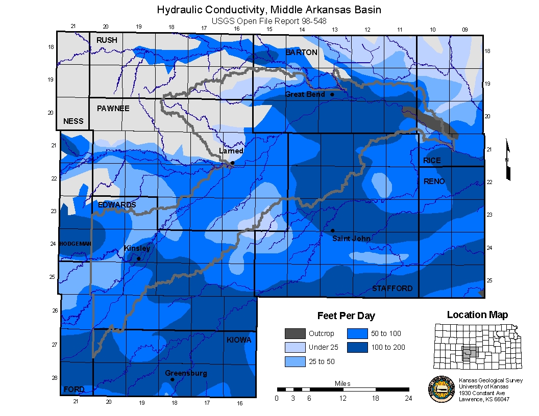
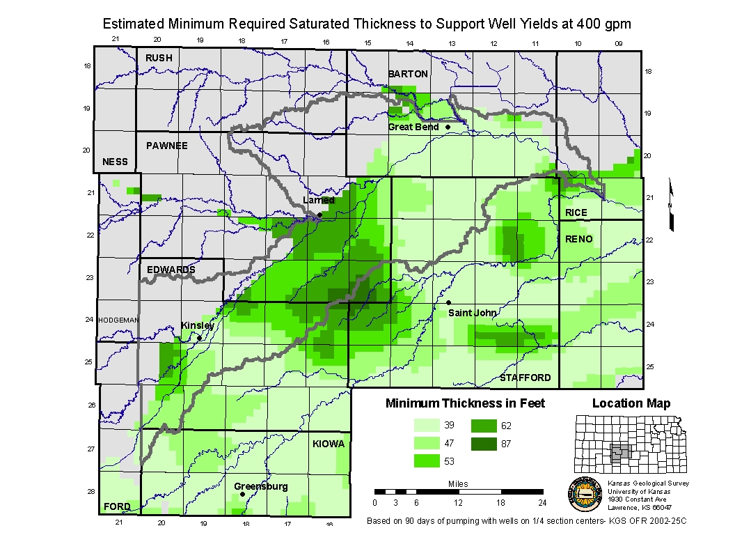
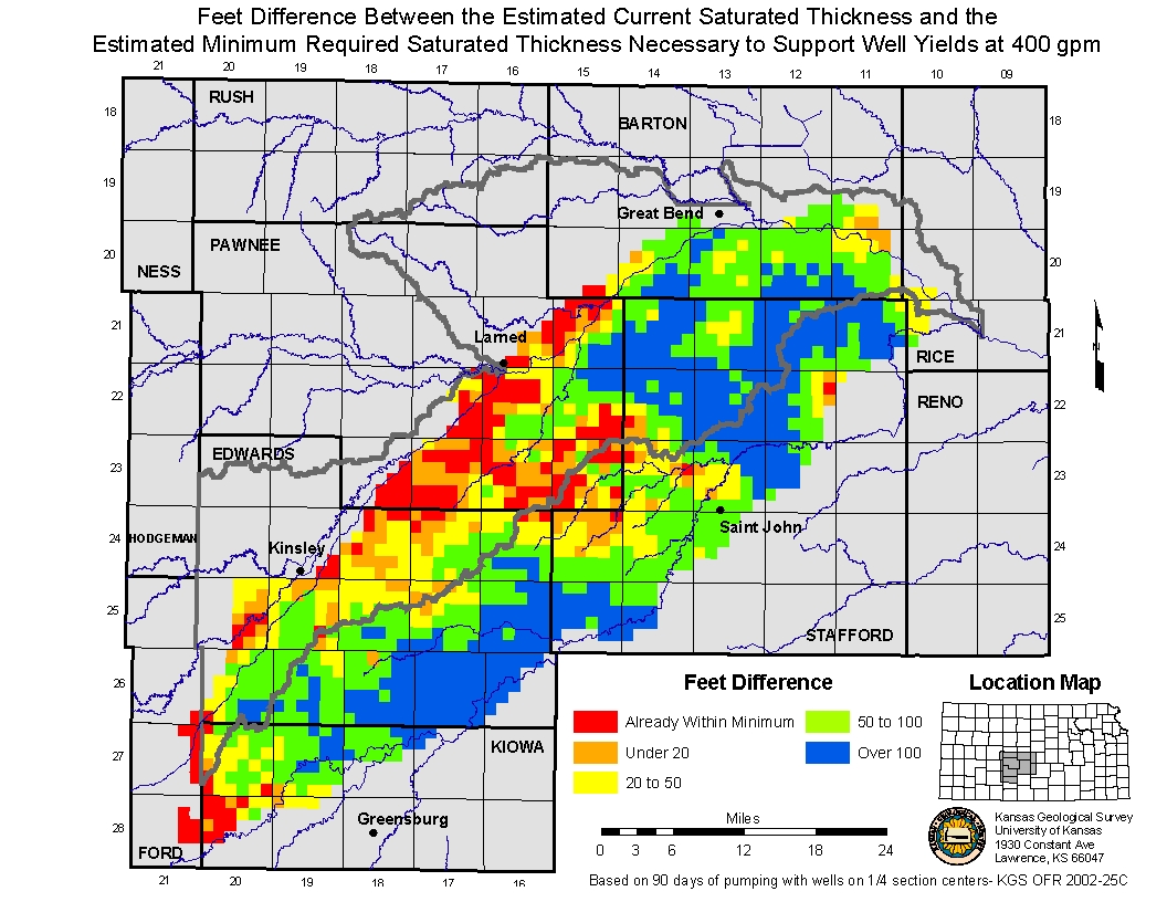
Map of Hydraulic Conductivity as defined by published reports from the USGS. New Estimated Usable Lifetime Map based on the required saturated thickness needed to support well yields of 400 gpm under a 5 spot well distribution pattern. |
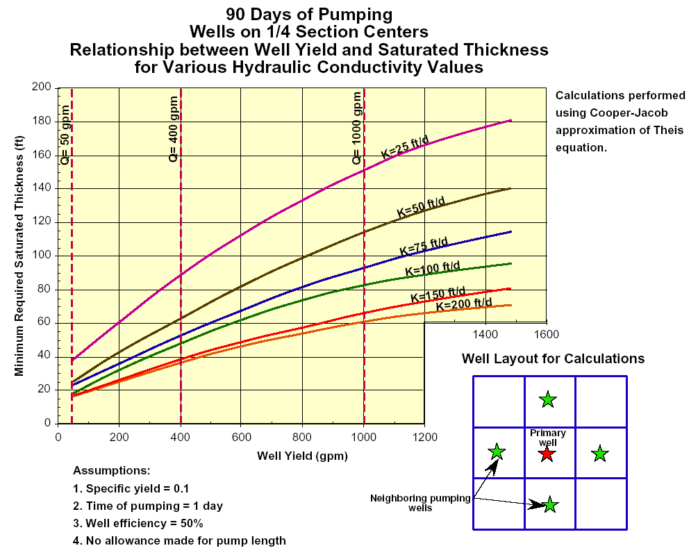
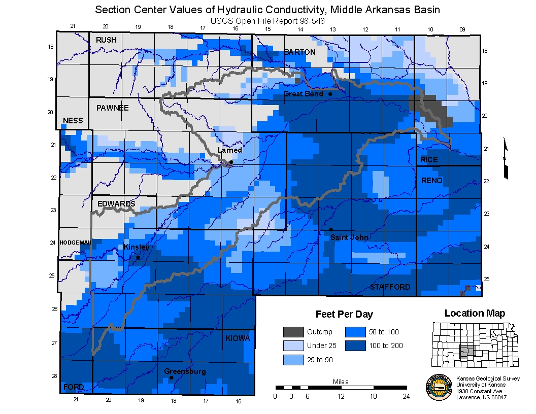
400 Yield Pumping Curve from KGS OFR 2002-25C. Hydraulic Conductivity as mapped by USGS. Hydraulic Conductivity assigned to section centers. Minimum Saturated Thickness thresholds for 400 gpm well yields. Differences between the current saturated thickness and minimum thresholds. |
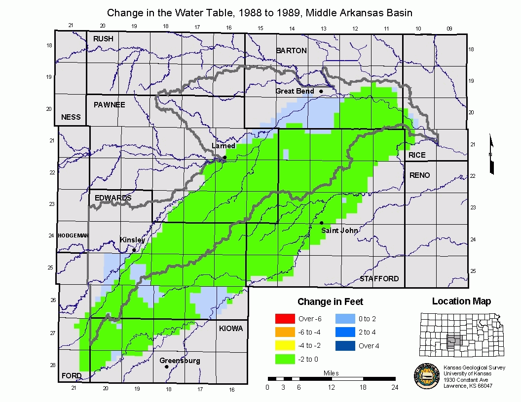
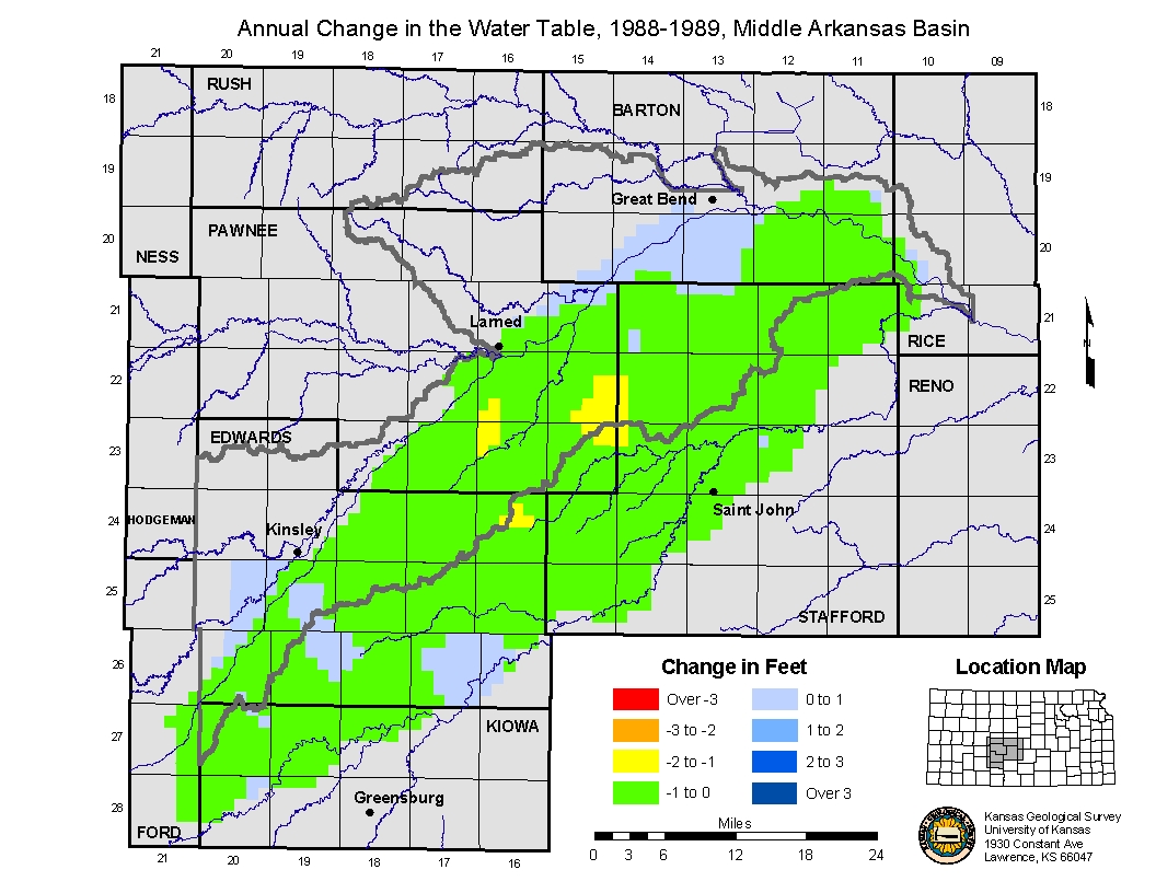
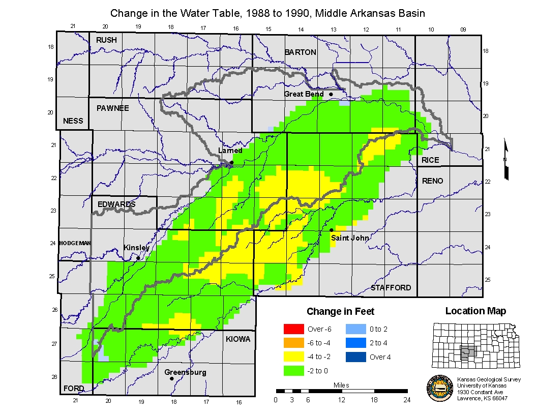
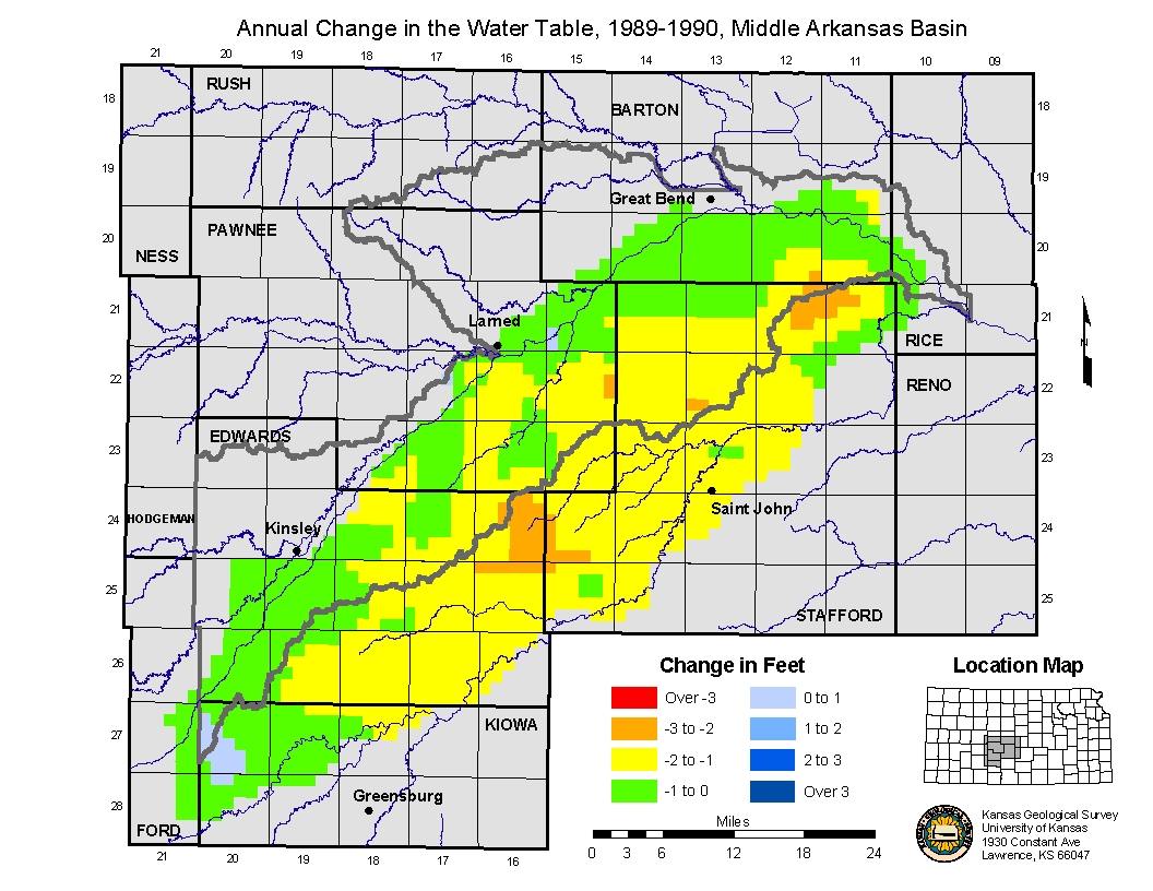
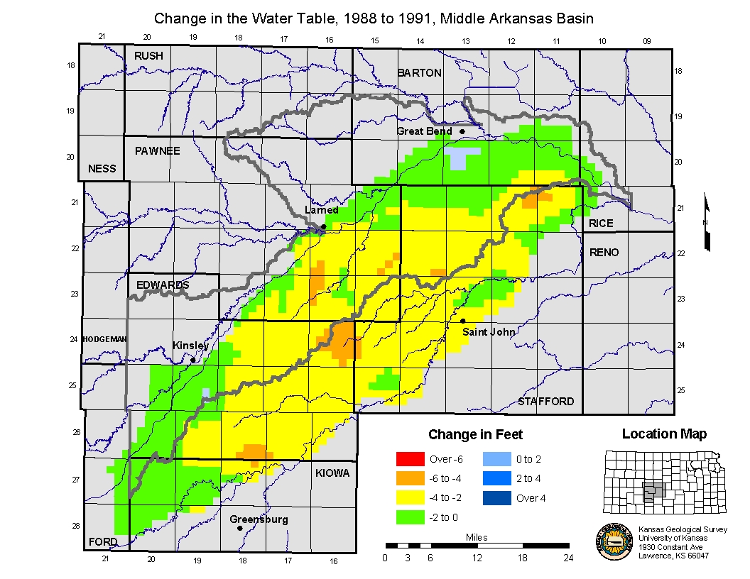
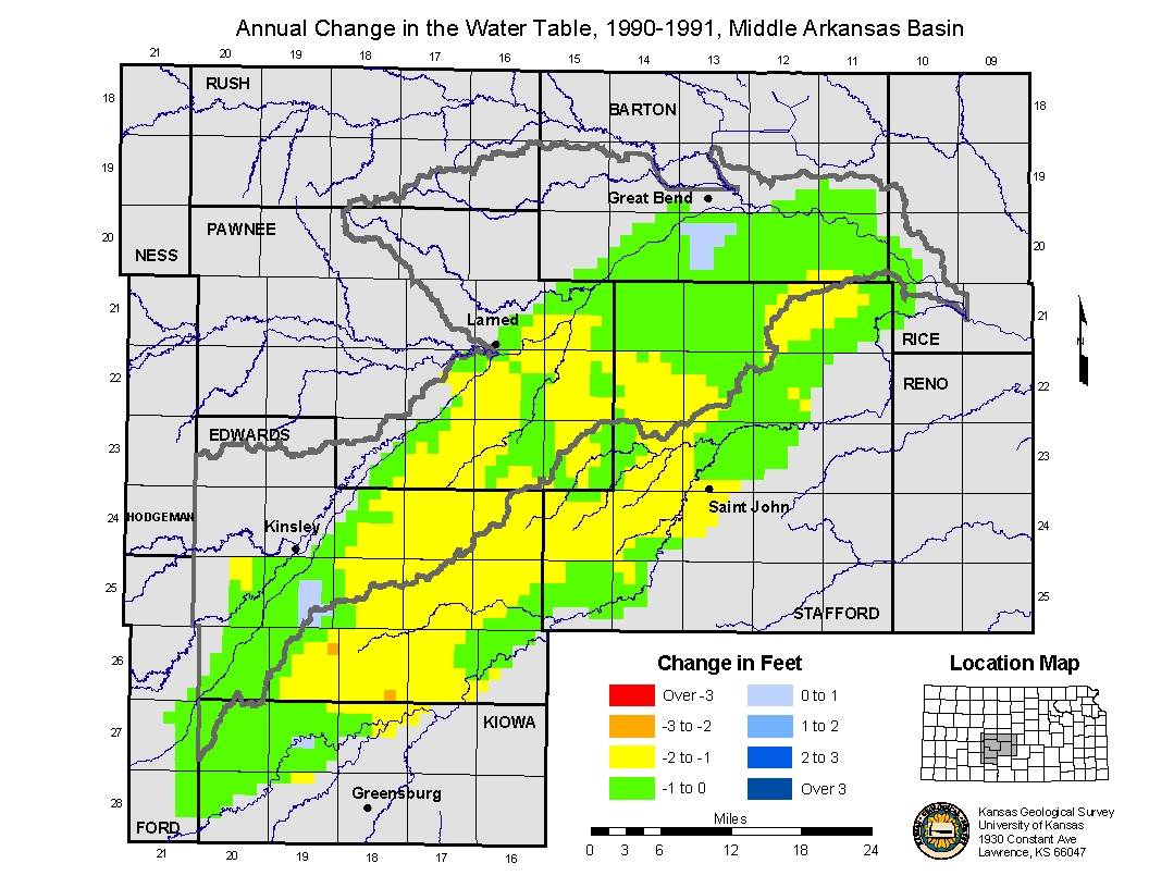
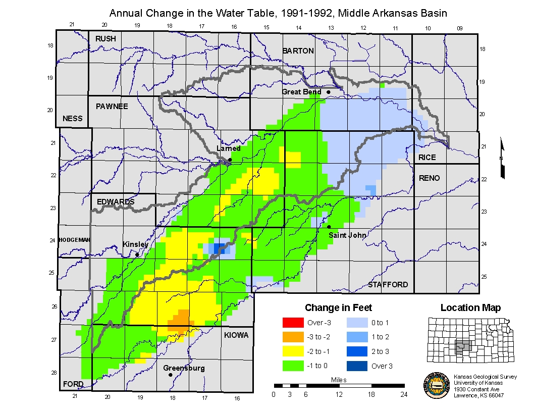
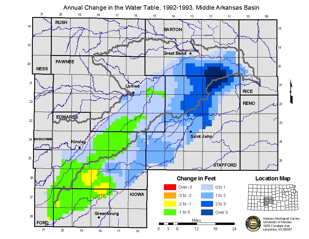
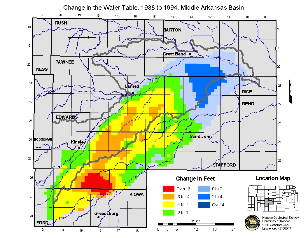
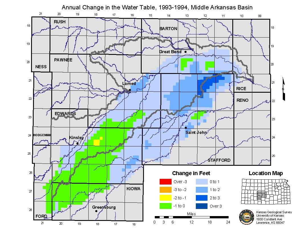
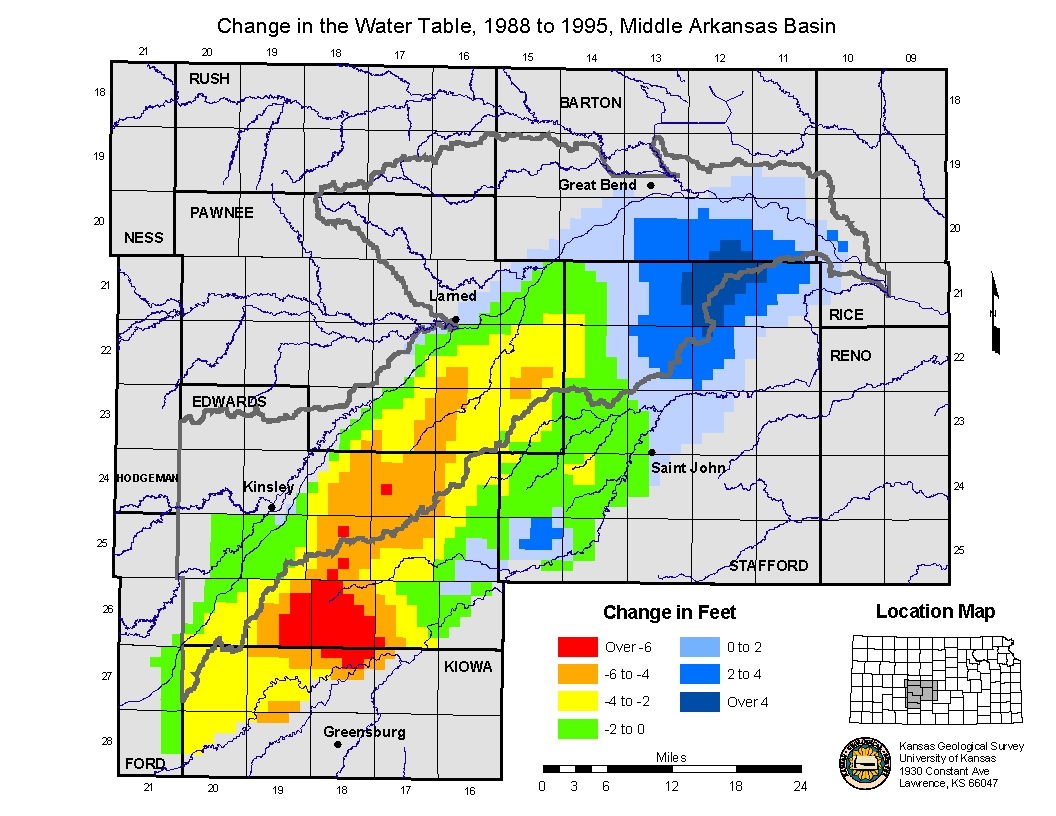
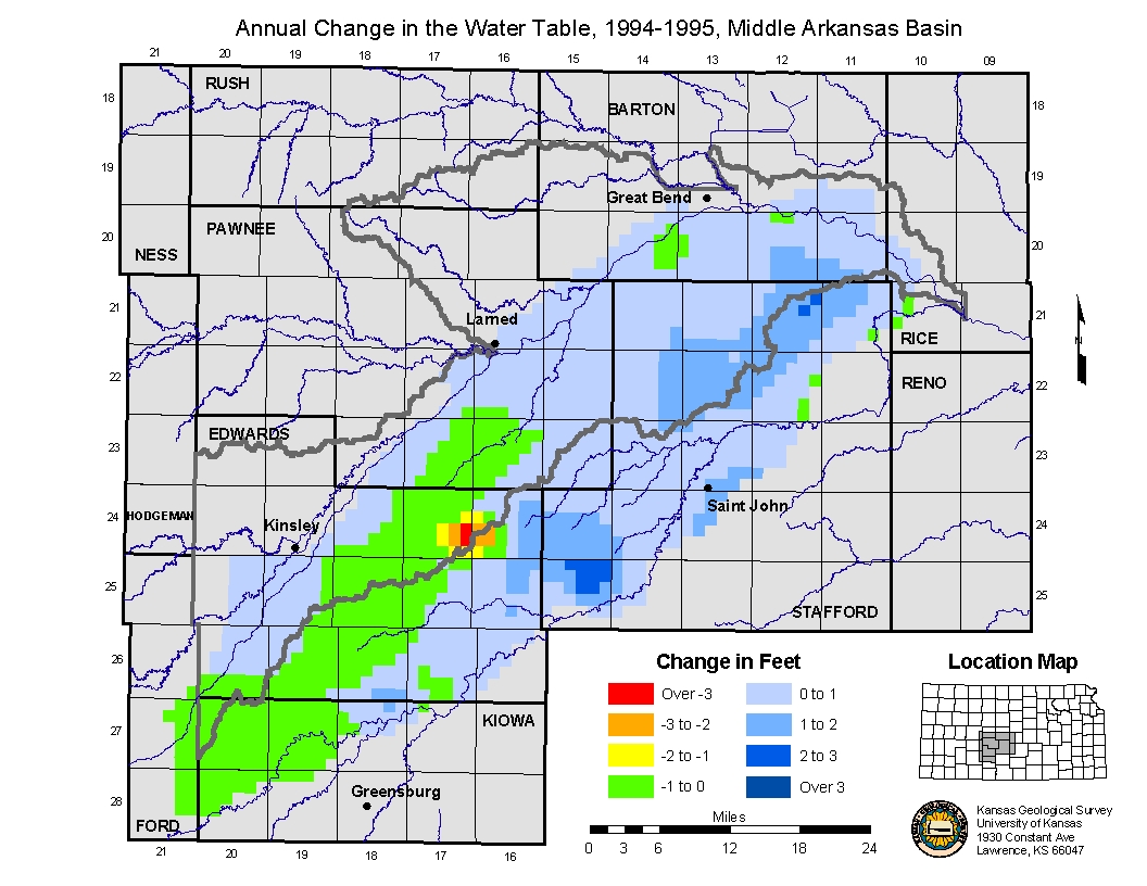
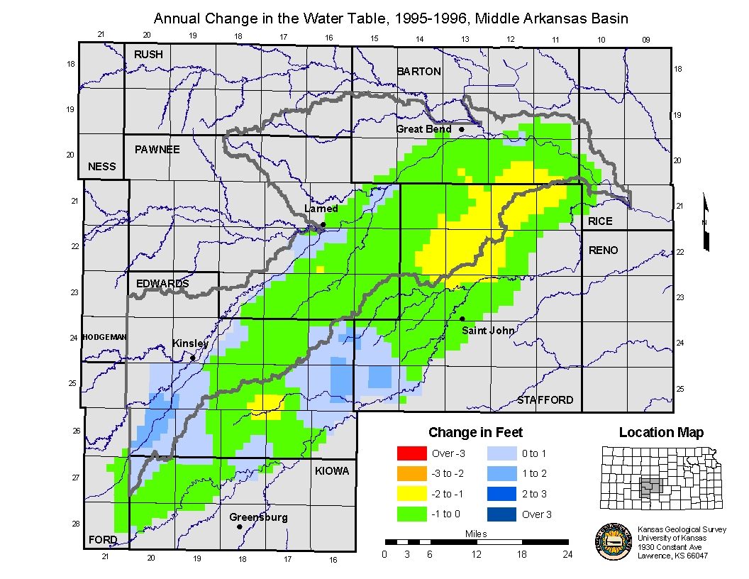
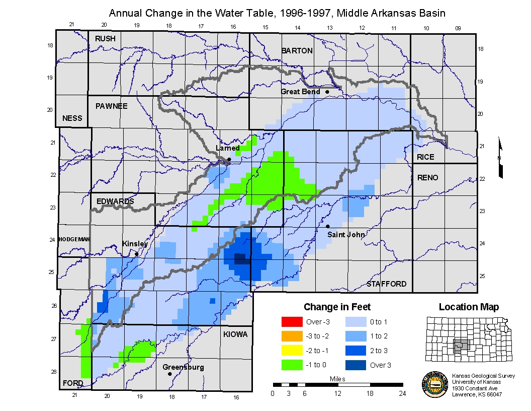
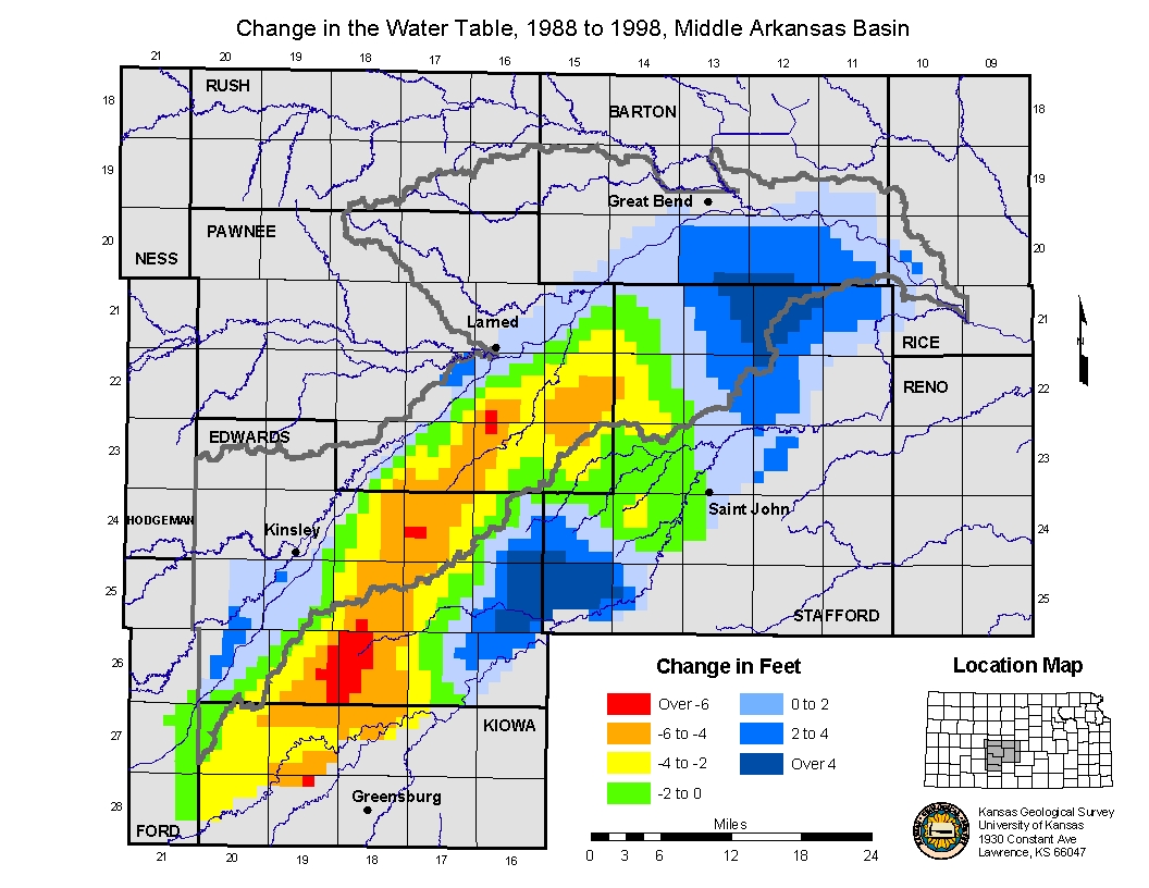
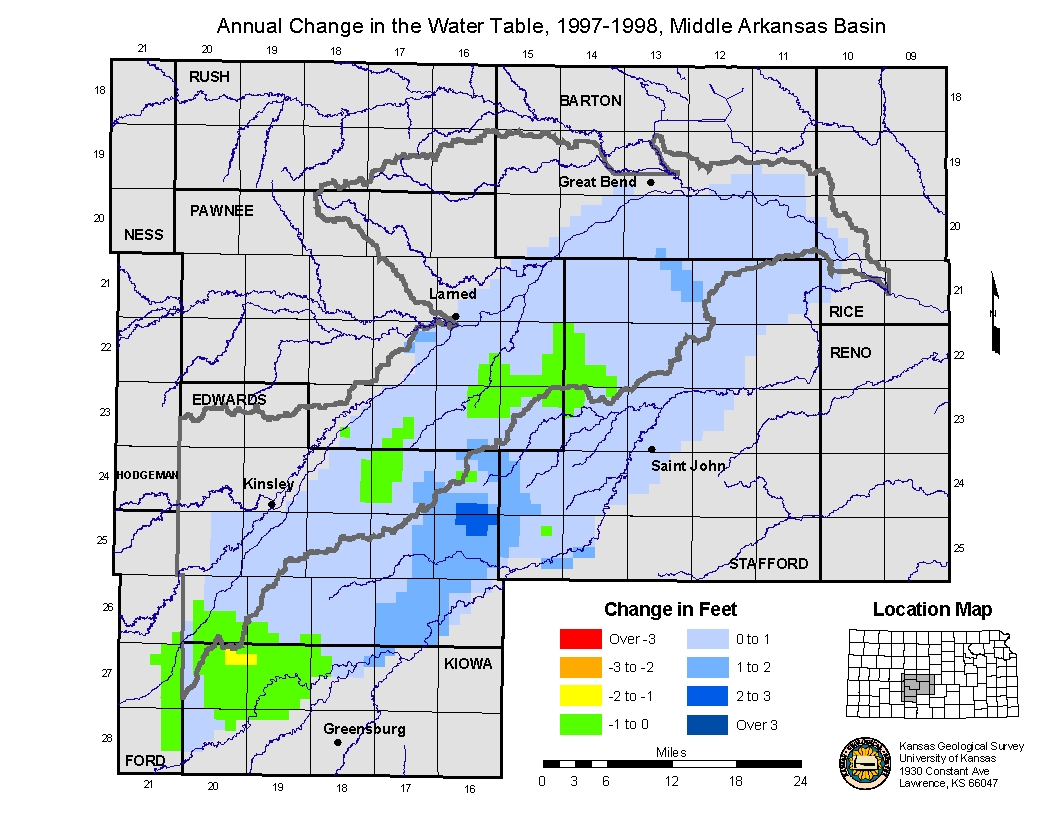
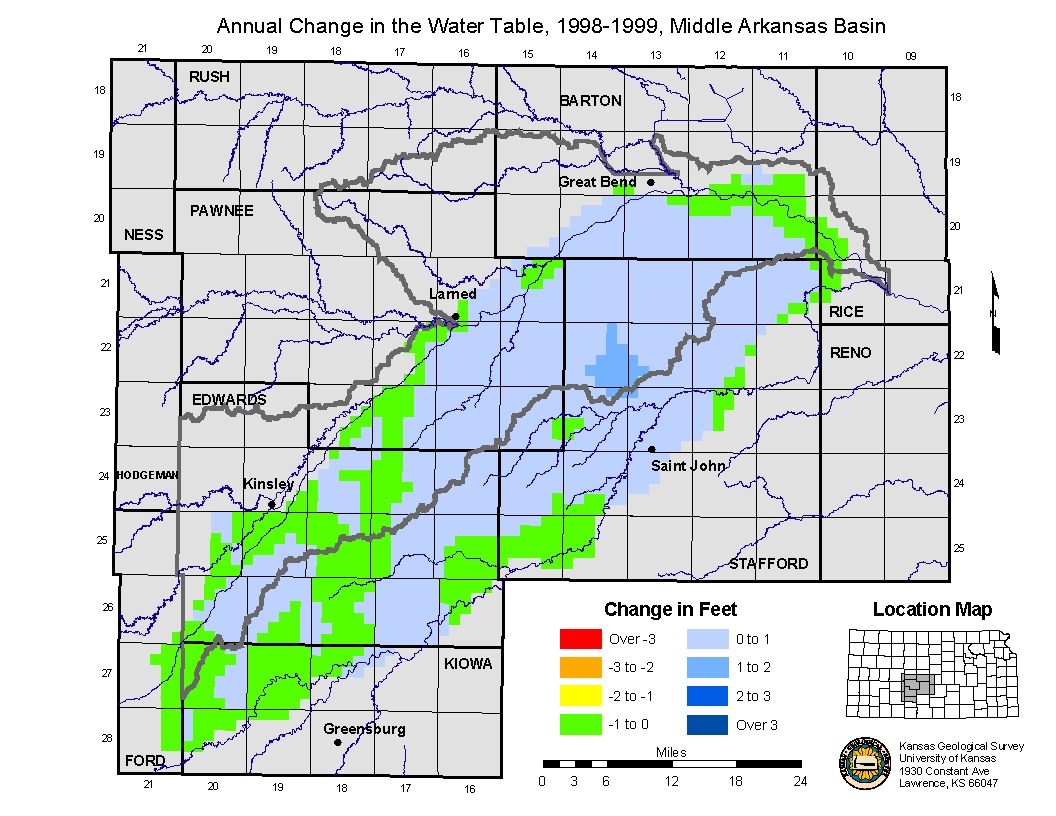
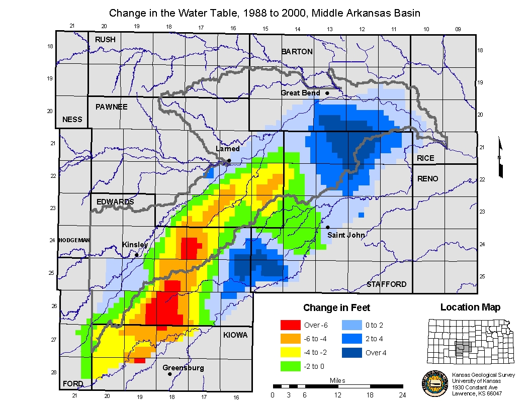
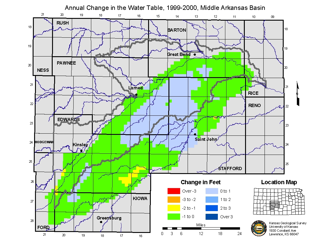
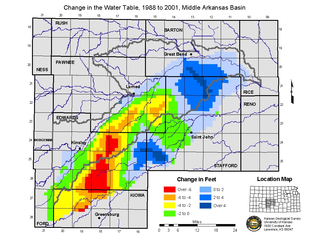
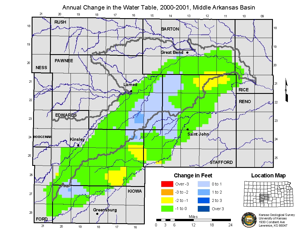
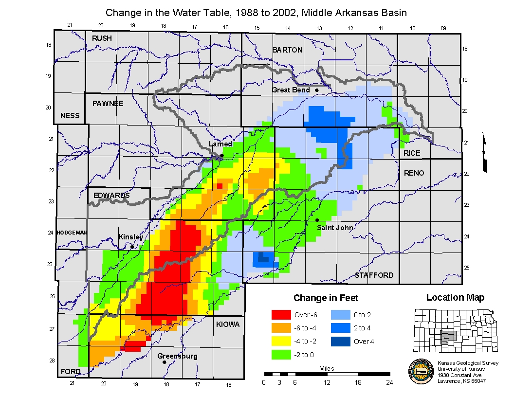
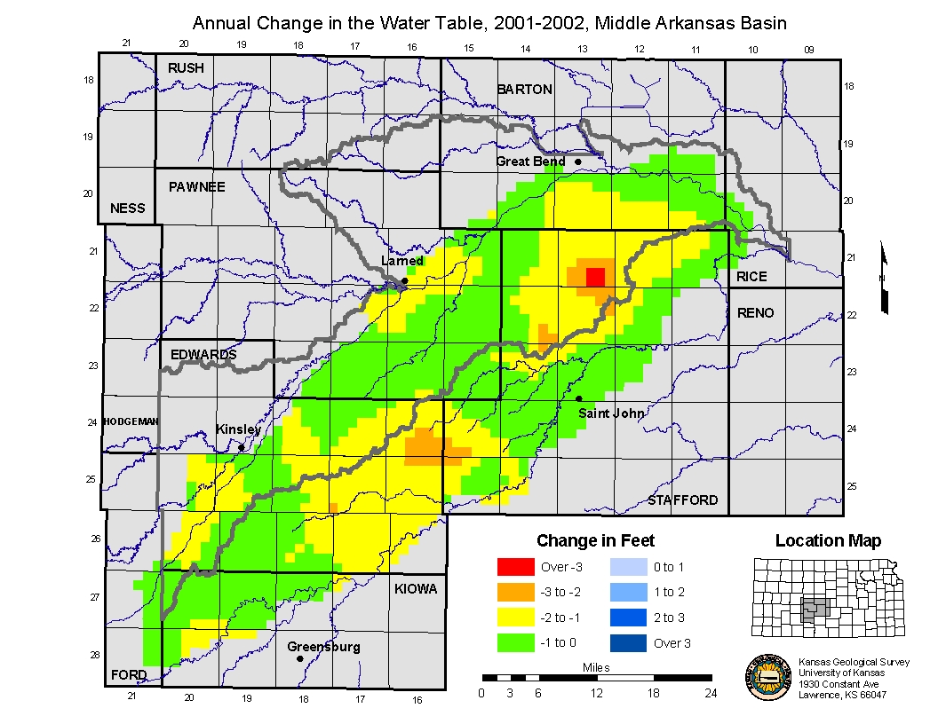
| Annual Rate of Change based on current 2003 depth to water measurement (1988-2003). |
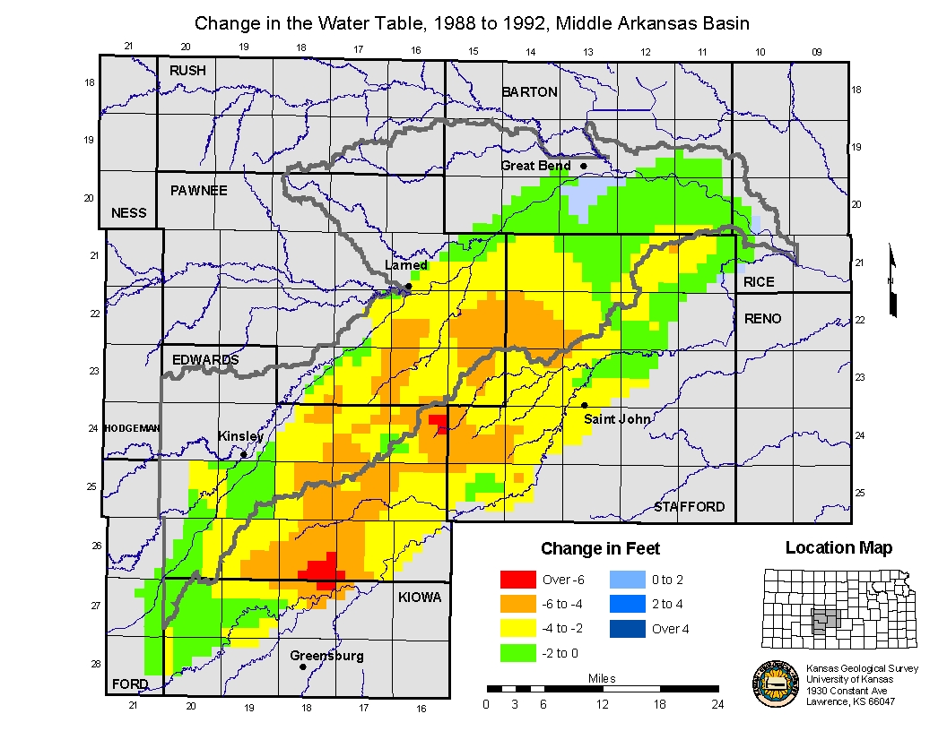
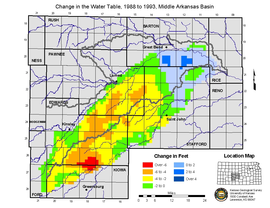
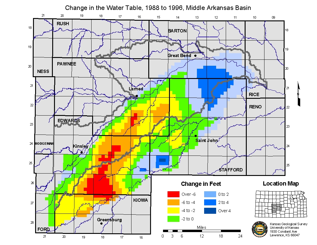
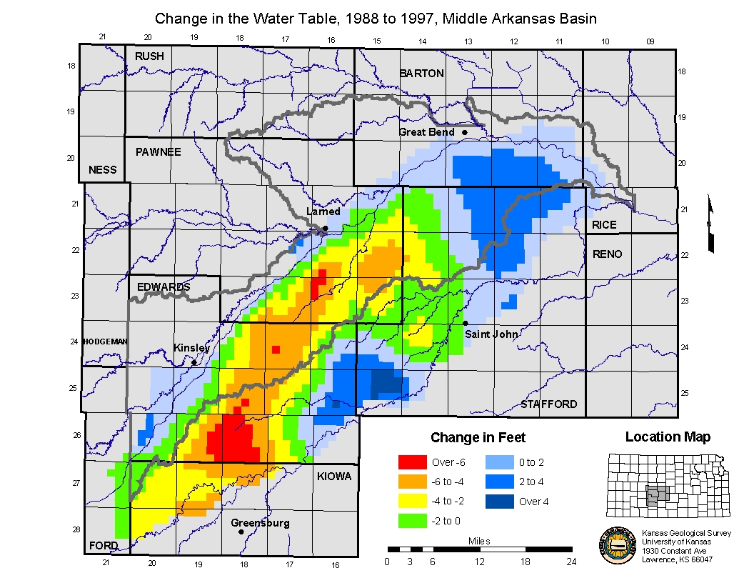
Animated Map of composite change 1988 to 2003. Water Level change from 1988 to 1989.-- Annual Trend from 1988 to 1989. Water Level change from 1988 to 1990.-- Annual Trend from 1989 to 1990. Water Level change from 1988 to 1991.-- Annual Trend from 1990 to 1991. Water Level change from 1988 to 1992.-- Annual Trend from 1991 to 1992. Water Level change from 1988 to 1993.-- Annual Trend from 1992 to 1993. Water Level change from 1988 to 1994.-- Annual Trend from 1993 to 1994. Water Level change from 1988 to 1995.-- Annual Trend from 1994 to 1995. Water Level change from 1988 to 1996.-- Annual Trend from 1995 to 1996. Water Level change from 1988 to 1997.-- Annual Trend from 1996 to 1997. Water Level change from 1988 to 1998.-- Annual Trend from 1997 to 1998. Water Level change from 1988 to 1999.-- Annual Trend from 1998 to 1999. Water Level change from 1988 to 2000.-- Annual Trend from 1999 to 2000. Water Level change from 1988 to 2001.-- Annual Trend from 2000 to 2001. Water Level change from 1988 to 2002.-- Annual Trend from 2001 to 2002. |
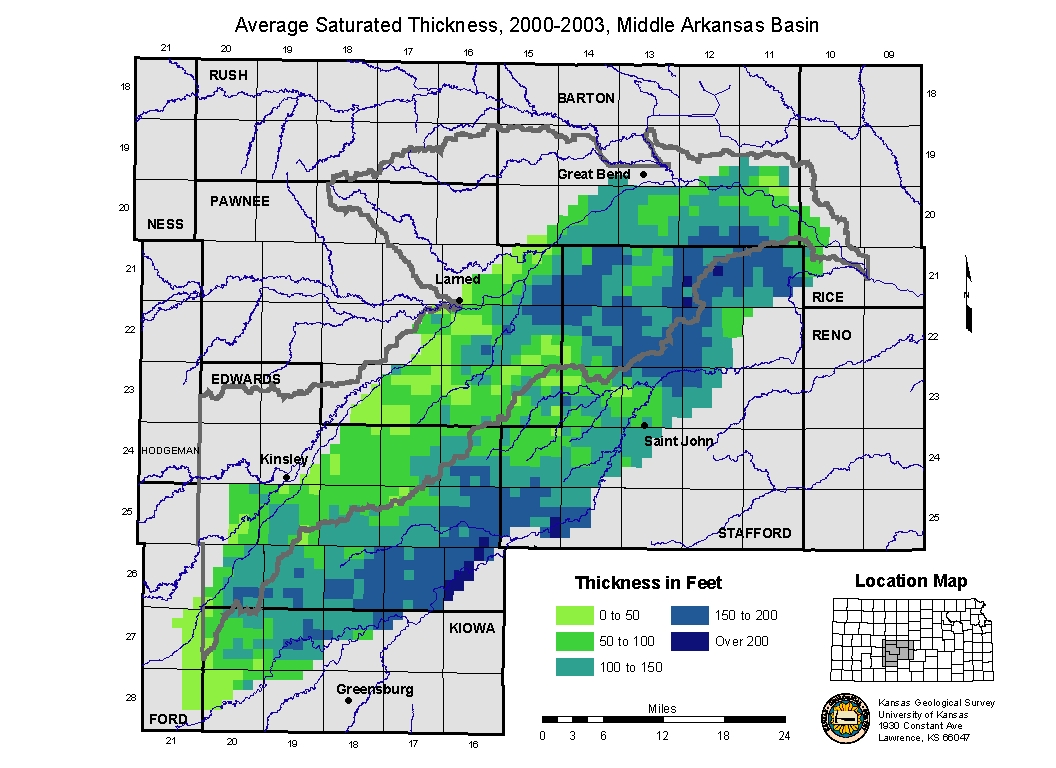
| Current Saturated Thickness map. |
Current Saturated Thickness (average 2000 to 2003). Differences between the current saturated thickness and minimum thresholds. |
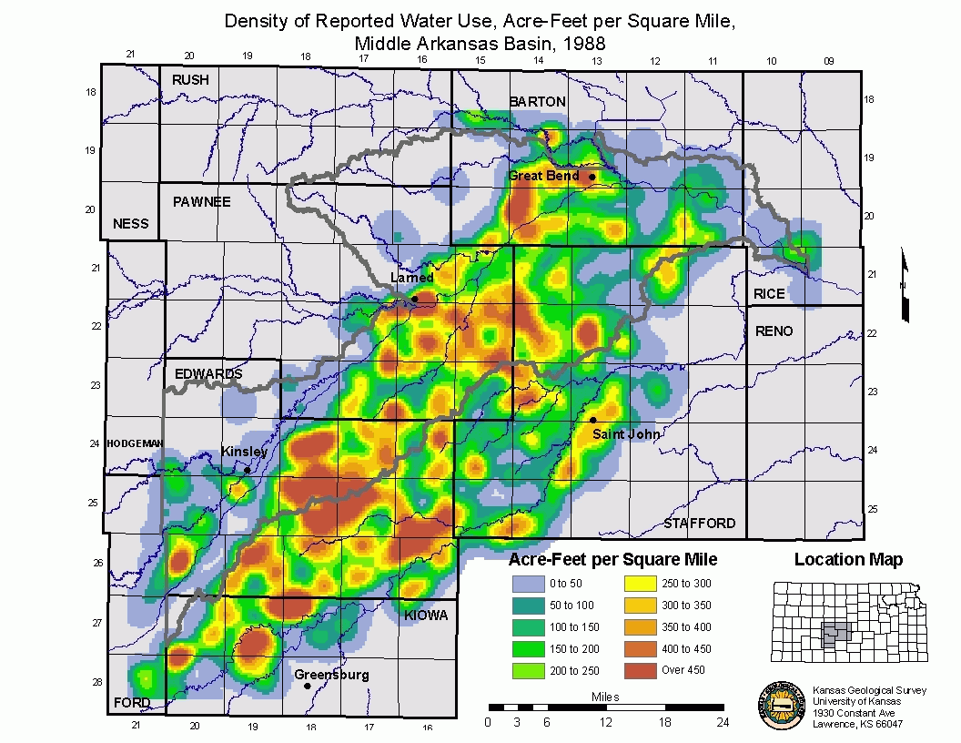
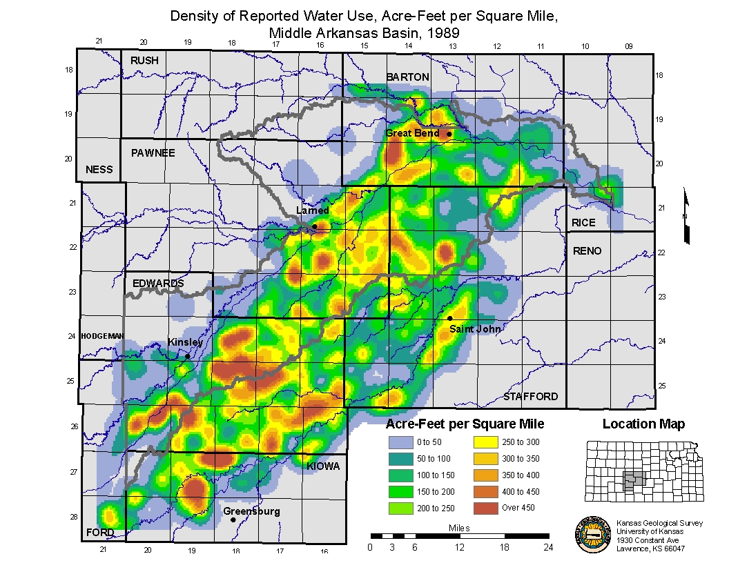
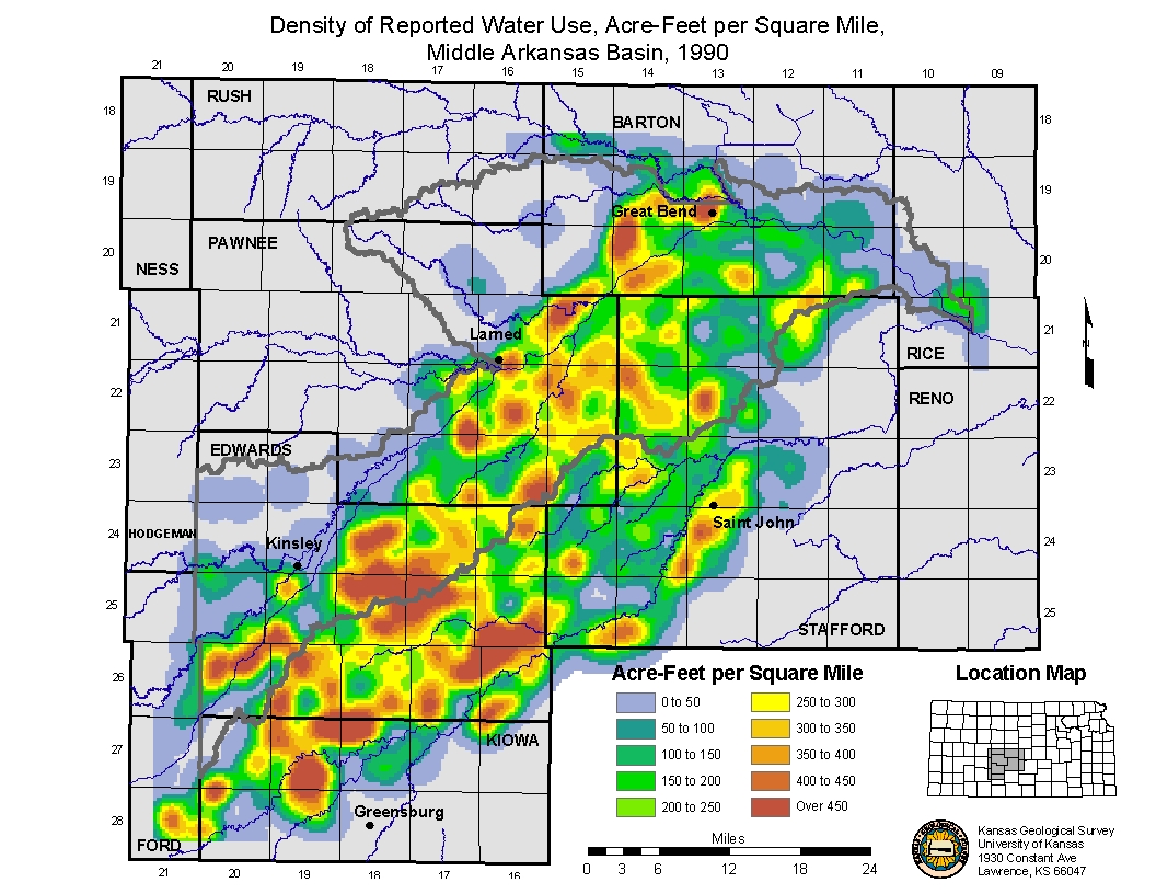
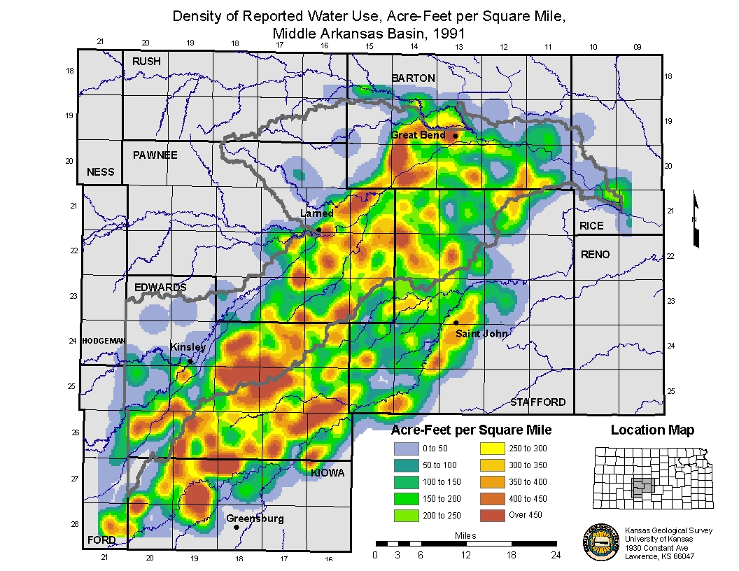
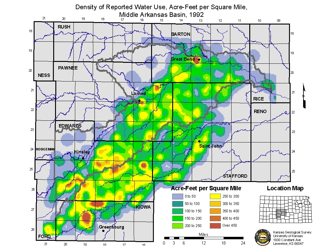
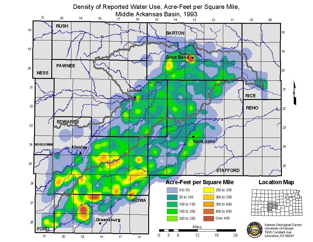
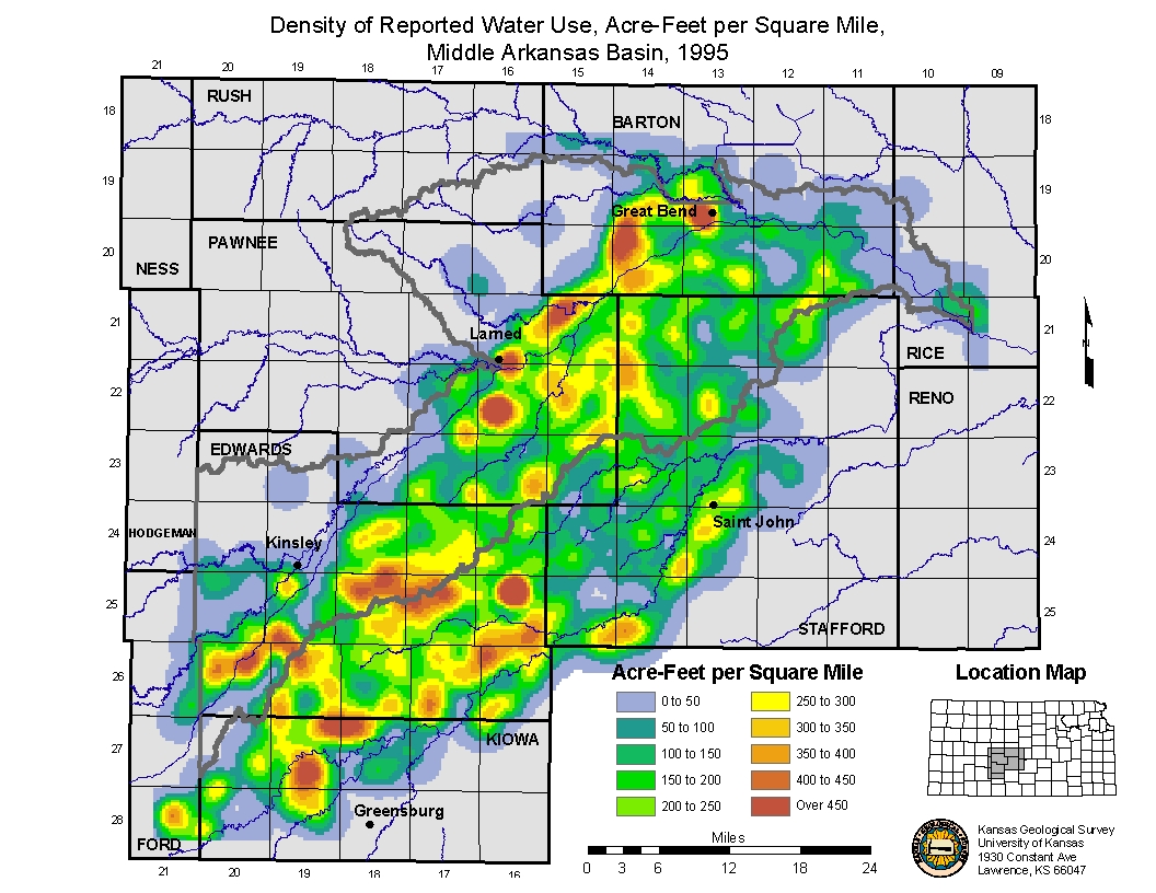
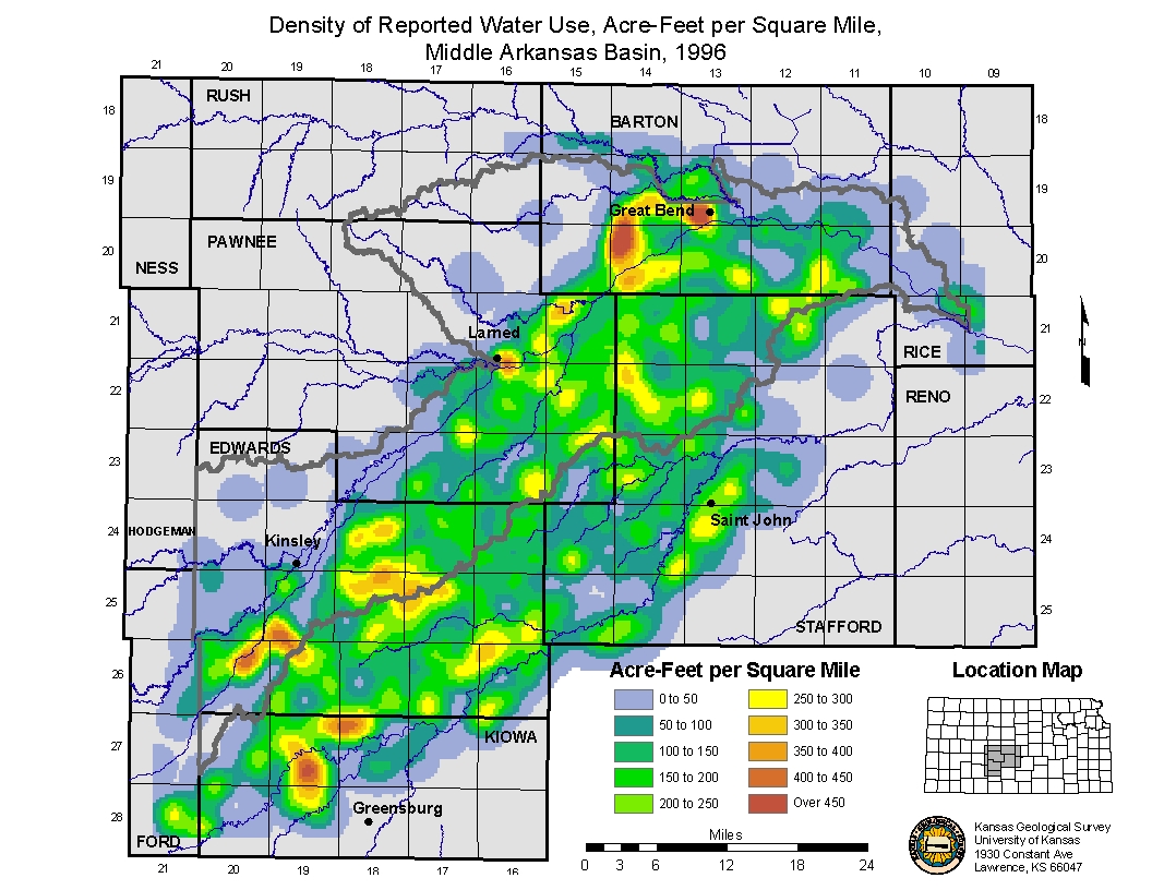
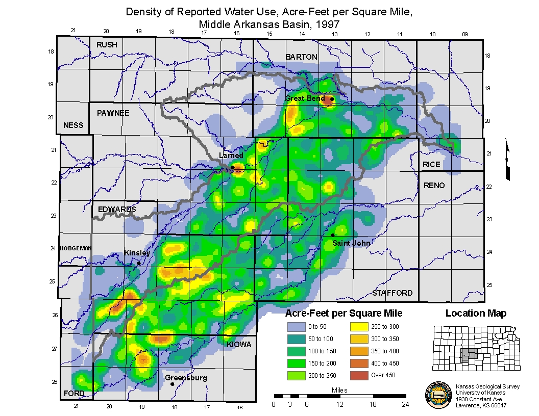
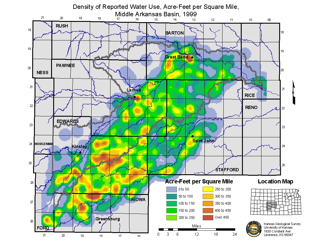
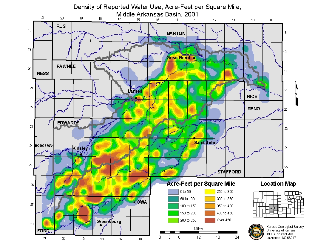
| Density Map of Average Reported Water Usage from 1988 to current (2001) using a 2-mile search radius. |
Animated Map of water use density from 1988 to 2001. Water Use Density 1988. Water Use Density 1989. Water Use Density 1990. Water Use Density 1991. Water Use Density 1992. Water Use Density 1993. Water Use Density 1994. Water Use Density 1995. Water Use Density 1996. Water Use Density 1997. Water Use Density 1998. Water Use Density 1999. Water Use Density 2000. Water Use Density 2001. Water Use Density Average 1988 to 2001. |
|
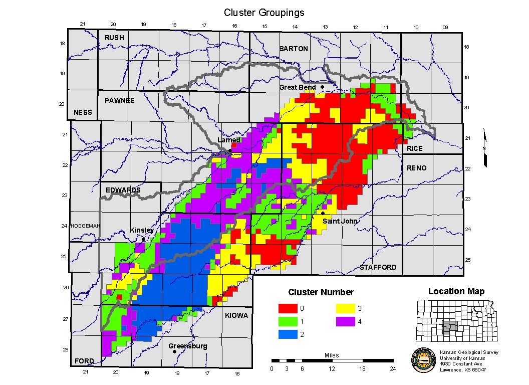
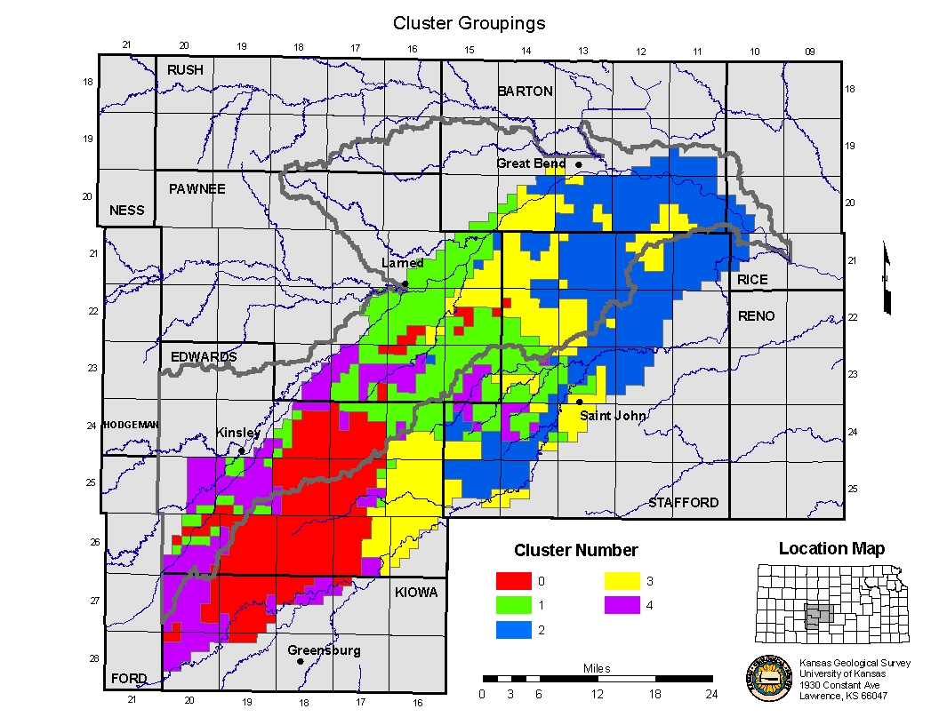
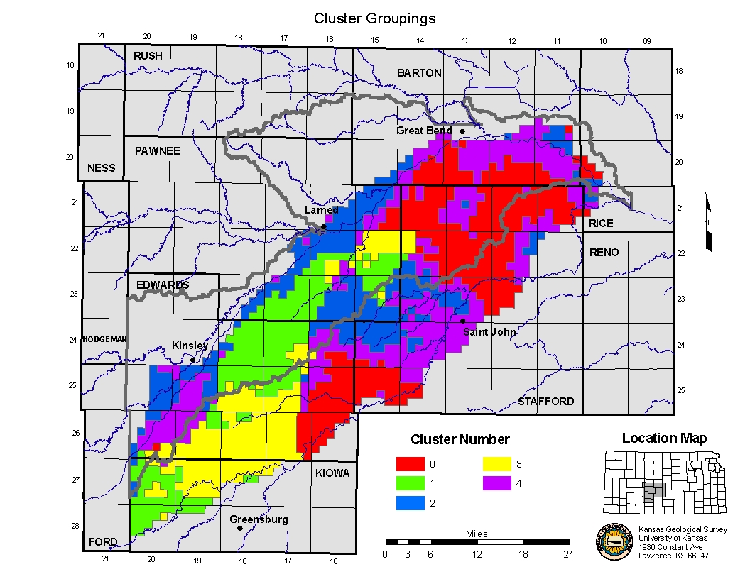
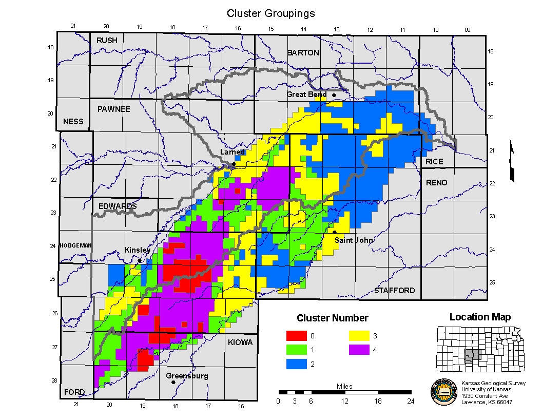
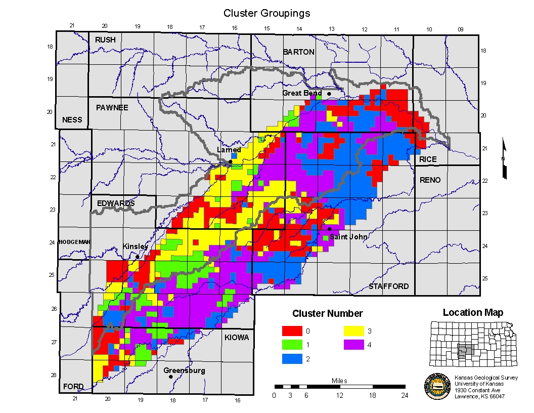
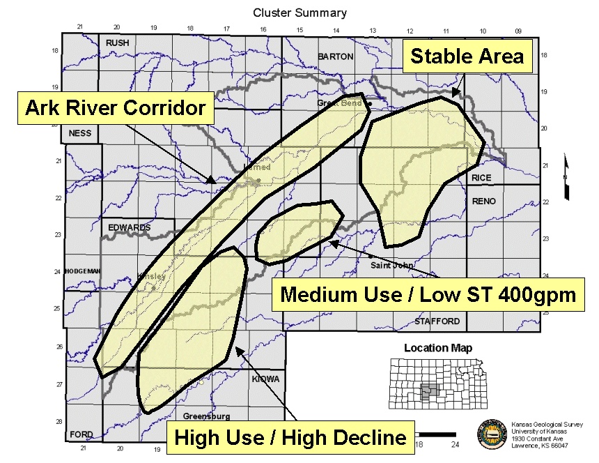
Targeting map of priority areas based on clustering techniques. |
Cluster 1 Map and Report (WL_CHNG, ST400, WUSE). Cluster 2 Map and Report (WL_CHNG, ST400, WUSE, LAT/LONG). Cluster 3 Map and Report (WL_CHNG, ST400). Cluster 4 Map and Report (WL_CHNG, WUSE). Cluster 5 Map and Report (WUSE, ST400). Cluster Summary. |
|
Other Items of interest. |
Click Here to see the powerpoint file presentented at the 04/15/2003
Middle Arkansas BMT Working Group Meeting or Right Mouse Click Here and save target as... to get the actual file. A description of LoiczView (LV): http://palantir.swarthmore.edu/loicz/help/ The new evolution of LV is the "DISCO" clustering routines (user name and password required): http://narya.engin.swarthmore.edu/disco/ |