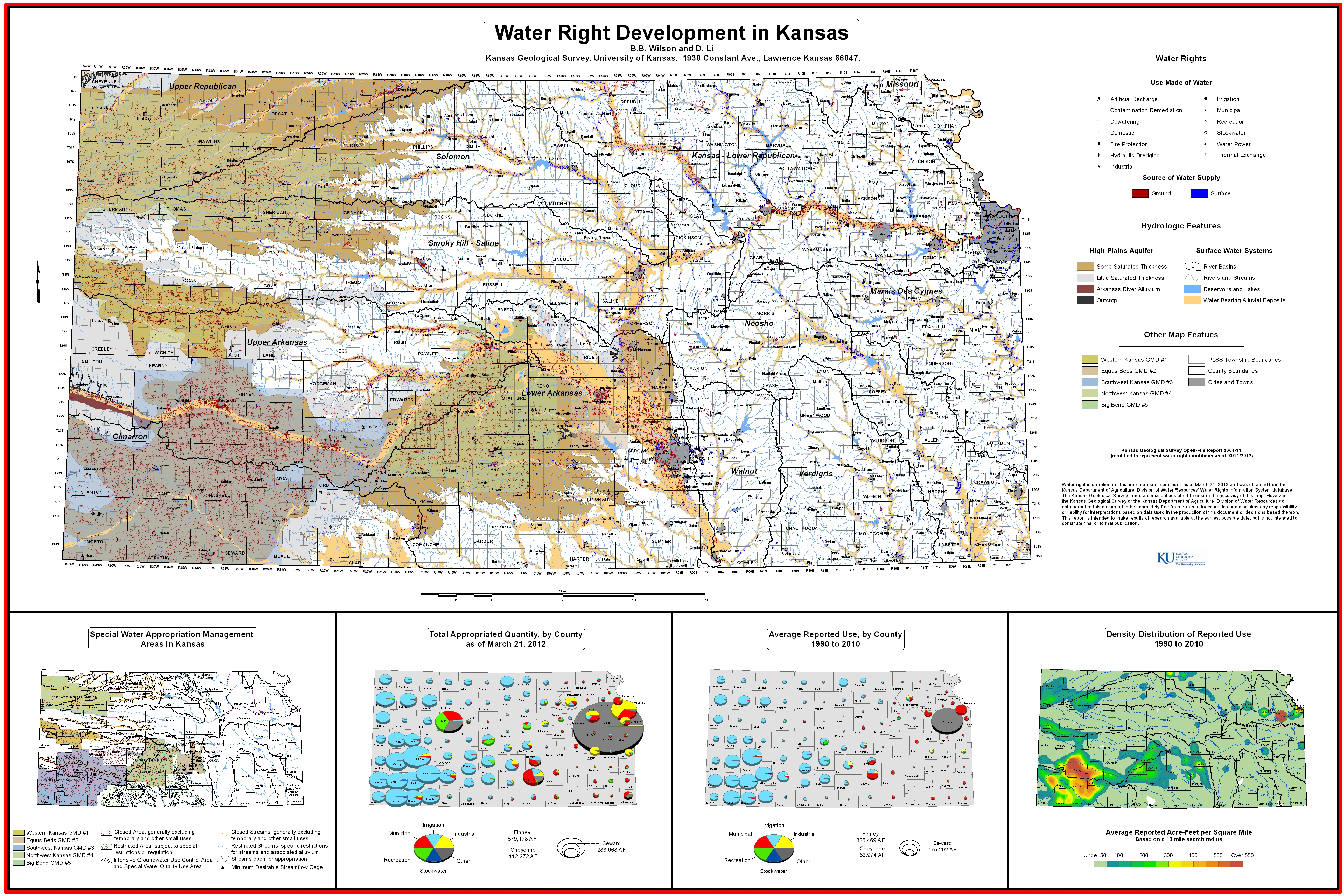
This open file report is a map developed by the Kansas Geological Survey showing water right development in Kansas. Given the dynamic nature of water rights, information on the map represents conditions as of March 21, 2012 and is subject to change.
 |
|
 |
Water right information on this map represent conditions as of March 21, 2012 and was obtained from the Kansas Department of Agriculture, Division of Water Resources' Water Rights Information System database. The Kansas Geological Survey made a conscientious effort to ensure the accuracy of this map. However, the Kansas Geological Survey or the Kansas Department of Agriculture, Division of Water Resources do not guarantee this document to be completely free from errors or inaccuracies and disclaims any responsibility or liability for interpretations based on data used in the production of this document or decisions based thereon. This report is intended to make results of research available at the earliest possible date, but is not intended to constitute final or formal publication. |